 |
Id: 374, Quality: 4Group: tcr2021Location: NottinghamPostcode: NG2 5AXMap Reference: 52.9396, -1.1021Ride length: 54 kmAdded by: Terry Barnaby | This ride is pretty much all in the Vale of Belvoir on almost entirely quiet roads. Stop early at either of the nice cafe at Velo Verde or Kingfisher Lodge. Shortly afterwards pass through ASLOCKTON the birthplace of Archbishop Cranmer one of the most significant influences in the history of religio ... |
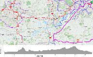 |
Id: 384, Quality: 2Group: tcr2021Location: NottinghamPostcode: NG2 5AXMap Reference: 52.9396, -1.1021Ride length: 52 kmAdded by: Terry Barnaby | This is a short and relatively easy route. It starts following the south bank of the River Trent before joining a well surfaced cycle track through the suburb of CLIFTON. Quiet roads and cycle tracks take you into Kegworth. There is one short (12%) climb on this section. You could stop for a cafe in ... |
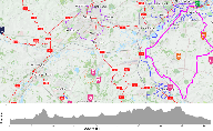 |
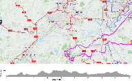
Id: 383, Quality: 2Group: tcr2021Location: NottinghamPostcode: NG2 5AXMap Reference: 52.9396, -1.1021Ride length: 65 kmAdded by: Terry Barnaby | It starts following the south bank of the River Trent before joining a well surfaced cycle track through the suburb of CLIFTON. Quiet roads and cycle tracks take you into Kegworth. There is one short (12%) climb on this section. You could stop for a cafe in Kegworth or go onto to Normanton (cafe or ... |
 |
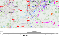
Id: 382, Quality: 2Group: tcr2021Location: NottinghamPostcode: NG2 5AXMap Reference: 52.9396, -1.1021Ride length: 91 kmAdded by: Terry Barnaby | This is the longest and hardest ride with significant climbing (Approx 900m), some of it steep (12%). The reward is a superb section through Calke Abbey Park and Staunton Harrold Estate. It is possible to return from Kegworth by a much shorter route. It starts following the south bank of the River T ... |
 |
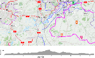
Id: 380, Quality: 2Group: tcr2021Location: NottinghamPostcode: NG2 5AXMap Reference: 52.9395, -1.10205Ride length: 64 kmAdded by: Terry Barnaby | A rewarding ride with a moderate amount of climbing. After avoiding the busier roads of West Bridgford it follows a pleasant rural route passing Close to the Stilton Creamery Cropwell Bishop. There are plenty of cafes and pubs on route. You could shorten this route by at 36.1 SO to Upper Broughton a ... |
 |
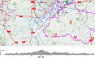
Id: 379, Quality: 2Group: tcr2021Location: NottinghamPostcode: NG2 5AXMap Reference: 52.9395, -1.10205Ride length: 76 kmAdded by: Terry Barnaby | A relatively easy ride with only a moderate amount of climbing. After avoiding the busier roads of West Bridgford it follows a pleasant rural route passing the Stilton Creameries of Long Clawson and Cropwell Bishop. There are plenty of cafes and pubs on route. You could shorten this route by at 36.1 ... |
 |
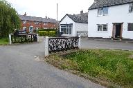
Id: 378, Quality: 2Group: tcr2021Location: NottinghamPostcode: NG2 5AXMap Reference: 52.9395, -1.10205Ride length: 89 kmAdded by: Terry Barnaby | A relatively easy long ride with only a moderate amount of climbing. After avoiding the busier roads of West Bridgford it follows a pleasant rural route passing the Stilton Creameries of Long Clawson and Cropwell Bishop. There are plenty of cafes and pubs on route. You could shorten this route by at ... |
 |
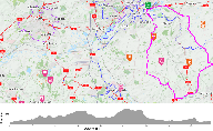
Id: 377, Quality: 2Group: tcr2021Location: NottinghamPostcode: NG2 5AXMap Reference: 52.9396, -1.10209Ride length: 63 kmAdded by: Terry Barnaby | Fairly quiet roads lead to Six Hills followed by a slightly busier section along an old droving road (The Salt Road) that runs most of the length of the Belvoir Ridge. After Lakeview Cafe, a favourite with local cyclists there is a steep descent from the Ridge. Shortly afterwards you pas the Colston ... |
 |
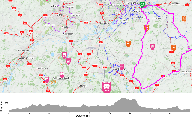
Id: 376, Quality: 2Group: tcr2021Location: NottinghamPostcode: NG2 5AXMap Reference: 52.9396, -1.10209Ride length: 71 kmAdded by: Terry Barnaby | Fairly quiet roads lead to Six Hills after a short section on the B676 a rolling section leads to Hoby and the Wreake valley to Asfordby. From here there is an lovely lane that climbs the easy way up onto the Belvoir Ridge. On this lane you pass the site of the Asfordby Super Pit, the last deep mine ... |
 |
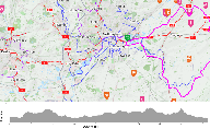
Id: 375, Quality: 2Group: tcr2021Location: NottinghamPostcode: NG2 5AXMap Reference: 52.9396, -1.10209Ride length: 81 kmAdded by: Terry Barnaby | Fairly quiet roads lead to Sileby before the route turns NW to follow the Wreake valley to Asfordby. From here there is a lovely lane that climbs the easy way up onto the Belvoir Ridge. On this lane you pass the site of the Asfordby Super Pit, the last deep mine built in the UK at a cost of GBP340 m ... |
 |
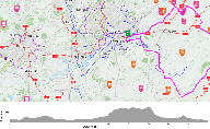
Id: 373, Quality: 2Group: tcr2021Location: NottinghamPostcode: NG2 5AXMap Reference: 52.9396, -1.1021Ride length: 74 kmAdded by: Terry Barnaby | This ride is pretty much all in the Vale of Belvoir on almost entirely quiet roads. It's only slighter shorter than SE-L Harby but is easier because it does not climb up onto the Belvoir ridge. It could also be shortened by not going through Redmile and past the Cafe at Dove Cottage. (See Map) Howev ... |
 |
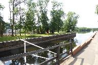
Id: 372, Quality: 2Group: tcr2021Location: NottinghamPostcode: NG2 5AXMap Reference: 52.9396, -1.1021Ride length: 80 kmAdded by: Terry Barnaby | This ride is pretty much all in the Vale of Belvoir on almost entirely quiet roads. It's a relatively easy ride and even the climb up to the Belvoir ridge is not particular steep, offering great views of the castle and the estate. You may wish to visit https://www.belvoircastle.com/ (booking may be ... |
 |
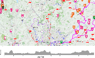
Id: 371, Quality: 2Group: tcr2021Location: NottinghamPostcode: NG2 5AXMap Reference: 52.9396, -1.1021Ride length: 51 kmAdded by: Terry Barnaby | This is an easy that would suit a really nice day. Cycle to Gunthorpe and relax beside the River Trent, or even take a short walk from the lock along the river bank before returning to visit the cafe, pub or the ice cream van. After leaving the Trent there is a short steep climb into East Bridgford. ... |
 |
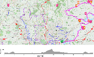
Id: 370, Quality: 2Group: tcr2021Location: NottinghamPostcode: NG2 5AXMap Reference: 52.9396, -1.1021Ride length: 87 kmAdded by: Terry Barnaby | This route pretty much avoids any busy roads all the way to Southwell and back through Newark. If you plan to visit Southwell Minster and/or The Workhouse (NT) and the Castle or Civil War Museum in Newark then leave early. (Bookings may be necessary for visits to The Workhouse, Southwell Minster or ... |
 |
Id: 369, Quality: 2Group: tcr2021Location: NottinghamPostcode: NG2 5AXMap Reference: 52.9396, -1.1021Ride length: 72 kmAdded by: Terry Barnaby | This route pretty much avoids any busy roads all the way to Southwell. If you plan to visit Southwell Minster and The Workhouse (NT) then leave early. (Bookings may be necessary for visits to The Workhouse or Southwell Minster.) After leaving the Trent Valley near Fiskerton there is some climbing in ... |
 |
Id: 368, Quality: 2Group: tcr2021Location: NottinghamPostcode: NG2 5AXMap Reference: 52.9396, -1.1021Ride length: 74 kmAdded by: Terry Barnaby | This is an easy ride as there is little climbing; less than 300m in total. Apart from a short section of main road just before Newark virtually the whole of the route lies in the Trent Valley and is on pleasant quiet roads. If you plan to visit the Castle and the Civil War Museum in Newark then leav ... |

