
Account
Pictures
Tandem Club GPX/TCX Rides list
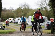
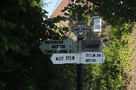
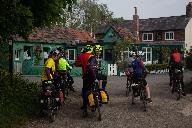
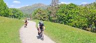
As a club we have many organised rides including national and international large events as well as local regional group rides. Quite a few of these have been made available to members using route sheets and more recently GPX/TCX files for sat navs. This is a database of all of these rides allowing you to view and download GPX/TCX files and route sheets where available.
We are slowly adding all of our rides to this database. If any member is willing to help that would be great ! These rides are provided on an as is basis if you ride them you do so entirely at your own risk. The Club, its officers and ride organisers accept no responsibility for loss, damage to property, accident, injury or death, that may occur, however caused, whether by negligence, deliberate act or otherwise. Any RO/member can add rides to make it easy for members to access them.
You can add rides using the Add Ride link. You must have a website login account to do this.By default the Selection criteria will be for rides in your own group. Set this to "All" to list all rides and click on the "Search" button. Some assistance with using this system is at: Help. You can just view and add places of interest using PlaceList. Note that when you have added a ride you can view it with a background map and proceed to add places of interest. This system is still a work in progress. Please feedback issues/ideas to: webgroup@tandem-club.org.uk.
We have just added all of the BCQ's to the system. See BCQ's
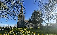
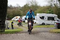
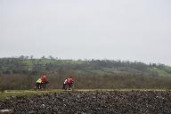
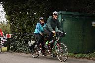
 | Id: 1939, Quality: 5Group: tce2026Location: Ashbourne CampsitePostcode: DE6 3ENMap Reference: 53.0184, -1.649Ride length: 82 kmAdded by: Neil Wheadon | Sun_TC5F_Monsal_Trail The NW rides (D, E & F) all begin with some vicious climbs onto the White Peak plateau, then try to stay up there, but cannot avoid falling into the occasional steep-sided dale! Route D to Bradford Dale and Youlgreave, is actually shorter than A, but a bit more hilly. Route E ... |
 | Id: 1938, Quality: 5Group: tce2026Location: Ashbourne CampsitePostcode: DE6 3ENMap Reference: 53.0184, -1.649Ride length: 69 kmRide ease: AverageAdded by: Neil Wheadon | Sun_TC5E_Monyash The NW rides (D, E & F) all begin with some vicious climbs onto the White Peak plateau, then try to stay up there, but cannot avoid falling into the occasional steep-sided dale! Route D to Bradford Dale and Youlgreave, is actually shorter than A, but a bit more hilly. Route E exten ... |
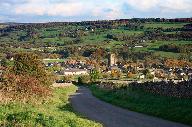 | Id: 1937, Quality: 5Group: tce2026Location: Ashbourne CampsitePostcode: DE6 3ENMap Reference: 53.0184, -1.649Ride length: 53 kmRide ease: AverageAdded by: Neil Wheadon | Sun_TC5D_Youlgrave The NW rides (D, E & F) all begin with some vicious climbs onto the White Peak plateau, then try to stay up there, but cannot avoid falling into the occasional steep-sided dale! Route D to Bradford Dale and Youlgreave, is actually shorter than A, but a bit more hilly. Route E ext ... |
 | Id: 1936, Quality: 5Group: tce2026Location: Ashbourne CampsitePostcode: DE6 3ENMap Reference: 53.0184, -1.649Ride length: 62 kmRide ease: AverageAdded by: Neil Wheadon | Sun_TC5C_Crom-Mills The SE history rides (A, B & C) all have 11ses at Kedleston Hall (NT) then go up the Derwent Valley by routes that avoid the A6 (and Wirksworth, because it's in a hole!) and re-unite on the High Peak Trail at Black Rocks. Route A goes straight along the E side of a sandstone rid ... |
 | Id: 1935, Quality: 5Group: tce2026Location: Ashbourne CampsitePostcode: DE6 3ENMap Reference: 53.0184, -1.649Ride length: 58 kmRide ease: AverageAdded by: Neil Wheadon | Sun_TC5B_Crom-Canal RIDDEN AT THE EVENT Head out of the campsite and you are soon into the quiet lanes heading south. These weave south east and you will see some lovely views below you. Kedleston Hall is accessed by a long driveway and the house will appear infront of you. There is a cafe here and ... |
 | Id: 1934, Quality: 5Group: tce2026Location: Ashbourne CampsitePostcode: DE6 3ENMap Reference: 53.0184, -1.649Ride length: 55 kmRide ease: AverageAdded by: Neil Wheadon | Sun_TC5A_BlackRocks This route unlike Cromford and the Cromford Canal avoids the first big climb to Middleton Top via the Dingle The SE history rides (A, B & C) all have 11ses at Kedleston Hall (NT) then go up the Derwent Valley by routes that avoid the A6 (and Wirksworth, because it's in a hole!) ... |
 | Id: 1933, Quality: 5Group: tce2026Location: Ashbourne CampsitePostcode: DE6 3ENMap Reference: 53.0184, -1.649Ride length: 76 kmRide ease: AverageAdded by: Neil Wheadon | Sat_TC4D_Marchington The main choice is to rail- trail or not, with optional extensions on either. Unlike yesterday: the shortest route A, is all-tar and although its extension B is a bit longer than C (the shortest to include the Great Northern Trail), it should be slightly easier and quicker. Rou ... |
 | Id: 1932, Quality: 5Group: tce2026Location: Ashbourne CampsitePostcode: DE6 3ENMap Reference: 53.0184, -1.649Ride length: 56 kmRide ease: AverageAdded by: Neil Wheadon | Sat_TC4C_Tutbury the main choice is to rail- trail or not, with optional extensions on either. Unlike yesterday: the shortest route A, is all-tar and although its extension B is a bit longer than C (the shortest to include the Great Northern Trail), it should be slightly easier and quicker. Route D ... |
 | Id: 1931, Quality: 5Group: tce2026Location: Ashbourne CampsitePostcode: DE6 3ENMap Reference: 53.0184, -1.649Ride length: 57 kmAdded by: Neil Wheadon | Sat_TC4B_Sudbury This ride just misses Tutbury, but a small diversion will take tou there. It also bypasses the Great Western Trail The main choice is to rail- trail or not, with optional extensions on either. Unlike yesterday: the shortest route A, is all-tar and although its extension B is a bit ... |
 | Id: 1930, Quality: 5Group: tce2026Location: Ashbourne CampsitePostcode: DE6 3ENMap Reference: 53.0184, -1.649Ride length: 46 kmRide ease: EasyAdded by: Neil Wheadon | Sat_TC4A_Marston on Dove The shortest ride A, is all-tar and although its extension B is a bit longer than C (the shortest to include the Great Northern Trail), it should be slightly easier and quicker. D is longest and includes the trail. As you can see from the map, all routes converge in the Hil ... |
 | Id: 1929, Quality: 5Group: tce2026Location: Ashbourne CampsitePostcode: DE6 3ENMap Reference: 53.0184, -1.64902Ride length: 99 kmRide ease: HardAdded by: Neil Wheadon | Fri_TC3D_Earl Sterndale Some riders nevertheless prefer the black stuff, so our longer route C (green) goes west to the Manifold Valley and follows a rail trail that is tarmac - albeit bumpy in parts! This route returns over the Weaver Hills to a highly recommended refreshment stop in Denstone. The ... |
 | Id: 1928, Quality: 5Group: tce2026Location: Ashbourne CampsitePostcode: DE6 3ENMap Reference: 53.0184, -1.64902Ride length: 81 kmAdded by: Neil Wheadon | Fri_TC3C_Manifold Valley Some riders nevertheless prefer the black stuff, so our longer route C (green) goes west to the Manifold Valley and follows a rail trail that is tarmac - albeit bumpy in parts! This route returns over the Weaver Hills to a highly recommended refreshment stop in Denstone. Th ... |
 | Id: 1927, Quality: 5Group: tce2026Location: Ashbourne CampsitePostcode: DE6 3ENMap Reference: 53.0184, -1.649Ride length: 69 kmRide ease: EasyAdded by: Neil Wheadon | Fri_TC3B_Parsley Hay RIDDEN This is a lovely ride. The top extension from TC3A is well worth it as it takes you along 2 beautifil valleys, gradually climbing to the Tissington Trail Route B (blue) extends A slightly, avoiding a steep approach to Hartington Station by taking the gentler and most sce ... |
 | Id: 1926, Quality: 5Group: tce2026Location: Ashbourne CampsitePostcode: DE6 3ENMap Reference: 53.0184, -1.649Ride length: 63 kmAdded by: Neil Wheadon | Fri_TC3A_High Peak Tissington The shortest route A (red on PDF map) makes more use of trails to minimise hills and traffic. These trails, by Carsington Water plus the High Peak and Tissington rail Trails, have reasonably good gravel surfaces that should be no problem unless your tyres are very narr ... |
 | Id: 1707, Quality: 5Group: PublishedRouteLocation: BA3 5LSPostcode: BA3 5LSMap Reference: 51.0064, -2.19841Ride length: 12 kmRide ease: EasyAdded by: Neil Wheadon | |
 | Id: 1698, Quality: 5Group: PublishedRouteLocation: GillinghamPostcode: SP8 4ATMap Reference: 51.0381, -2.27802Ride length: 24 kmRide ease: AverageAdded by: Neil Wheadon | This is the first part of the seemingly forgotten North Dorset Cycleway. Signs are still at most junctions, but there is nothing on the web, aside a pretty poor map on the Dorset County Council website. You start at Gillingham where there is a station, but for ease, I have used the closest car park ... |
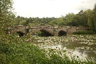
 | Id: 1570, Quality: 5Group: WestCountryLocation: MelkshamPostcode: SN12 8AGMap Reference: 51.3848, -2.14359Ride length: 66 kmRide ease: AverageAdded by: Neil Wheadon | Start - Leekes car park Beanacre Rd, Melksham SN12 8AG , free parking This is a fabulous ride, if you are in Melksham, thoroughly recommended This ride is an imaginative tip utilising quieter roads, cycleways and byways in the Western part of Wiltshire. Starting at the car par in Leeks, you will he ... |
 | Id: 1541, Quality: 5Group: LALocation: KendalPostcode: LA9 7HXMap Reference: 54.3158, -2.73943Ride length: 61 kmAdded by: Stephen Webb | Meet at Kendal Leisure Centre (Burton Rd, Kendal LA9 7HX) 9:15 for a 9:30 start. We will cycle through the town centre and take the road through Burneside to Bowston and Ings for a coffee stop at the Lakeland Farm (8 miles). Then it is up and across the gated lane to the B5284, past the golf course ... |
 | Id: 1335, Quality: 5Group: tcn2025Location: Tanner Farm campsitePostcode: TN12 9NDMap Reference: 51.1474, 0.47568Ride length: 75 kmRide ease: AverageAdded by: Philip Ingram | A ride through the verdant flatlands of the Low Weald through Headcorn and Grafty Green. Then uphill through the woods before crossing the M20 and heading for the Pilgrims Way along the lower slopes of the Downs. Then to onto the lovely buildings of Aylesford Priory and Aylesford. Then heading back ... |
 | Id: 1258, Quality: 5Group: PublishedRouteLocation: Market HarboroughPostcode: LE16 7DTMap Reference: 52.4788, -0.91012Ride length: 27 kmRide ease: EasyAdded by: Neil Wheadon | See https://www.sustrans.org.uk/find-a-route-on-the-national-cycle-network/brampton-valley-way/ Start at Market Harborough Station, St Mary's Rd, Market Harborough LE16 7DT SURFACE:- The Brampton Valley Way spans over 14 miles between Northampton and Market Harborough, what was once a disused railwa ... |
 | Id: 1122, Quality: 5Group: PublishedRouteLocation: HaverfordwestPostcode: SA61 1TPMap Reference: 51.8016, -4.96537Ride length: 42 kmRide ease: HardAdded by: Neil Wheadon | See https://www.pembrokeshire.gov.uk/cycle-pembrokeshire/cycle-pembrokeshire-wizo-trail Trave/map icon at https://tandem-club.org.uk/rides?cmd=placeView&id=10303 This was manually written up using RidewithGPS (with care) as no GPX was available. The Trail meanders through part of the central area of ... |
 | Id: 1060, Quality: 5Group: tcn2024Location: Alnwick Rugby Football Club, Greensfield, Willowburn Avenue, AlnwickPostcode: NE66 1BEMap Reference: 55.4025, -1.69862Ride length: 118 kmRide ease: HardAdded by: Joseph Bulloch | A scenic ride with views to the Cheviot Hills, north to Chillingham Castle and Etal Village and return via Wooler and Ingram in the beautiful Breamish Valley before returning to Alnwick. In detail: Eglingham, Chillingham, Chatton, Doddington, Ford, Etal (Cafes) Kirknewton, Wooler (cafes) Ingram (Caf ... |
 | Id: 1059, Quality: 5Group: tcn2024Location: Alnwick Rugby Football Club, Greensfield, Willowburn Avenue, AlnwickPostcode: NE66 1BEMap Reference: 55.4023, -1.69862Ride length: 80 kmRide ease: AverageAdded by: Joseph Bulloch | A scenic ride with views to the Cheviot Hills, north to Chillingham Castle and Wooler then to Ingram in the beautiful Breamish Valley before returning to Alnwick. In detail: Eglingham, Chillingham, Chatton, Wooler (Cafes), Ingram (Cafe) Powburn, Alnwick Warning: There are fords at 22.5 and 40.4 mile ... |
 | Id: 1058, Quality: 5Group: tcn2024Location: Alnwick Rugby Football Club, Greensfield, Willowburn Avenue, AlnwickPostcode: NE66 1BEMap Reference: 55.4025, -1.69868Ride length: 64 kmRide ease: EasyAdded by: Joseph Bulloch | A scenic ride with views to the Cheviot Hills, north to Chillingham Castle and then to Ingram in the beautiful Breamish Valley before returning to Alnwick. In detail: Eglingham, Chillingham Castle (cafe) Ingram (Cafe), Powburn, Alnwick Warning: There are fords at 15.6 and 30.2 miles. There are pedes ... |
 | Id: 1057, Quality: 5Group: tcn2024Location: Alnwick Rugby Football Club, Greensfield, Willowburn Avenue, AlnwickPostcode: NE66 1BEMap Reference: 55.4025, -1.69862Ride length: 102 kmRide ease: HardAdded by: Joseph Bulloch | South along the coast through Warkworth, Amble, Druridge Bay and returning inland via Widdrington, Linton, Morpeth, Pigdon. Netherwitton, Pauperhaugh, Felton, Acklington and Shillbottle to Alnwick In detail: Warkworth, Amble, Druridge, (possibly Cresswell (Drift Cafe or village shop, public toilets ... |
 | Id: 1056, Quality: 5Group: tcn2024Location: Alnwick Rugby Football Club, Greensfield, Willowburn Avenue, AlnwickPostcode: NE66 1BEMap Reference: 55.4025, -1.69862Ride length: 80 kmRide ease: AverageAdded by: Joseph Bulloch | South along the coast through Warkworth, Amble, Druridge Bay and returning inland via Widdrington, Linton, Morpeth, Hebron, Tritlington, Acklington and Shillbottle to Alnwick. In detail: Warkworth, Amble, Druridge, (possibly Cresswell (Drift Cafe or village shop, public toilets in village, beach) Wi ... |
 | Id: 1055, Quality: 5Group: tcn2024Location: Alnwick Rugby Football Club, Greensfield, Willowburn Avenue, AlnwickPostcode: NE66 1BEMap Reference: 55.4025, -1.69862Ride length: 52 kmRide ease: EasyAdded by: Joseph Bulloch | South along the coast through Warkworth, Amble and Druridge Bay and returning inland via Widdrington, Acklington and Shilbottle to Alnwick. In detail: Warkworth, Amble, Druridge, (possibly Cresswell (Drift Cafe or village shop, public toilets in village, beach) Widdrington, Acklington, Shillbottle. ... |
 | Id: 1054, Quality: 5Group: tcn2024Location: Alnwick Rugby Football Club, Greensfield, Willowburn Avenue, AlnwickPostcode: NE66 1BEMap Reference: 55.4025, -1.69869Ride length: 111 kmRide ease: HardAdded by: Joseph Bulloch | A hilly ride via Rothbury to explore the Upper Coquet valley from Alwinton with the reward of extensive open views towards the Simonside and Cheviot Hills returning to Alnwick via Whittingham In detail: Rothbury, Whitton, Tosson, Harbottle, Alwinton (Pub), then out and back up Coquet Valley to Chew ... |
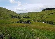
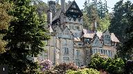 | Id: 1052, Quality: 5Group: tcn2024Location: Alnwick Rugby Football Club, Greensfield, Willowburn Avenue, AlnwickPostcode: NE66 1BEMap Reference: 55.4026, -1.69868Ride length: 49 kmRide ease: AverageAdded by: Joseph Bulloch | A hilly ride to Rothbury with the reward of extensive views to the Simonside and Cheviot Hills. Places to visit Rothbury:- Cragside, National Trust, Thropton, Cartington, Whittingham |
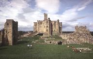
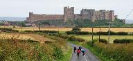
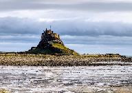 | Id: 1051, Quality: 5Group: tcn2024Location: Alnwick Rugby Football Club, Greensfield, Willowburn Avenue, AlnwickPostcode: NE66 1BEMap Reference: 55.4026, -1.69868Ride length: 117 kmRide ease: HardAdded by: Joseph Bulloch | North along the coast through small villages to Beadnell, Seahouses, Bamburgh, Belford and Beal to Holy Island (if tide times permit) returning to Waren Mill and then inland via Lucker and Rock to Alnwick. |
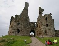
 | Id: 1050, Quality: 5Group: tcn2024Location: Alnwick Rugby Football Club, Greensfield, Willowburn Avenue, AlnwickPostcode: NE66 1BEMap Reference: 55.4025, -1.69868Ride length: 81 kmRide ease: AverageAdded by: Joseph Bulloch | North along the coast through small villages to Craster, Beadnell and Bamburgh and returning inland to Alnwick. In detail: Alnmouth, NCN 1 to Boulmer, Longhoughton (cafe), Craster (Cafe), Beadnell, continue on NCN 1 to Bamburgh, back via Warren Mill, Lucker |
 | Id: 1049, Quality: 5Group: tcn2024Location: Alnwick Rugby Football Club, Greensfield, Willowburn Avenue, AlnwickPostcode: NE66 1BEMap Reference: 55.4026, -1.69868Ride length: 61 kmRide ease: EasyAdded by: Joseph Bulloch | Su_S_38m_NorthCoast - Orriginal Rally name North along the coast through small villages to Craster and Beadnell and returning inland to Alnwick. In detail: Alnmouth, NCN 1 to Boulmer, Longhoughton (cafe), Craster (Cafe), Beadnell, Chathill, Denwick, Alnwick |
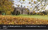
 | Id: 728, Quality: 5Group: tcn2023Location: Stratford-upon-Avon RacecoursePostcode: CV37 9SEMap Reference: 52.1835, -1.73052Ride length: 96 kmRide ease: HardAdded by: Neil Wheadon | Suggested day Places to eat Morning Coffee stop - New Inn and Community shop or Hatton Country World Lunch - Maybe a pub/cafe near Coventry but Kenilworth a better bet Afternoon stop - Charlecote or Touchdown Cafe Places of interest Stratford armories - will take about 20 minutes Warwick - Castle, b ... |
 | Id: 726, Quality: 5Group: tcn2023Location: Stratford-upon-Avon RacecoursePostcode: CV37 9SEMap Reference: 52.1836, -1.73049Ride length: 86 kmRide ease: HardAdded by: Neil Wheadon | Suggested Day Places to eat Morning stop - take a picnic to Samborne Lunch - Henley, cafes and picnic Afternoon stop - Yew Tree Farm Places to visit Coughton Court (National Trust) open after 11:00 Henley-in-Arden Henley may not seem an obvious target for a ride, but this small town has a charm of i ... |
 | Id: 725, Quality: 5Group: tcn2023Location: Stratford-upon-Avon RacecoursePostcode: CV37 9SEMap Reference: 52.1835, -1.73037Ride length: 53 kmRide ease: EasyAdded by: Neil Wheadon | Suggested Day REFRESHMENTS Morning tea stop - Walton Hall Hotel . This is an organised and paid for stop Lunch - Kineton or Charlecote Afternoon Stop - Charlecote PLACES TO VISIT Charlecote (National Trust) There is the interesting Civil War exhibit in the church at Radway that adds 10km there and b ... |
 | Id: 724, Quality: 5Group: tcn2023Location: Stratford-upon-Avon RacecoursePostcode: CV37 9SEMap Reference: 52.1835, -1.73037Ride length: 91 kmRide ease: AverageAdded by: Neil Wheadon | Suggested Day REFRESHMENTS Morning tea stop - Walton Hall Hotel . This is an organised and paid for stop Lunch - Kineton or a picnic along the way Afternoon Stop - Charlecote PLACES TO VISIT Charlecote (National Trust) There is the interesting Civil War exhibit in the church at Radway that adds 10km ... |
 | Id: 723, Quality: 5Group: tcn2023Location: Stratford-upon-Avon RacecoursePostcode: CV37 9SEMap Reference: 52.1835, -1.73037Ride length: 109 kmRide ease: AverageAdded by: Neil Wheadon | Suggested Day REFRESHMENTS Morning tea stop - Hotel at Walton. This is an organised and paid for stop Lunch - Clopredy, multiple places to choose from Afternoon Stop - Ginks Cafe at Kineton PLACES TO VISIT Church at Radway - Civil War exhibit, worth 10 minutes of your life Upton House and Gardens (N ... |
 | Id: 722, Quality: 5Group: tcn2023Location: Stratford-upon-Avon RacecoursePostcode: CV37 9SEMap Reference: 52.1835, -1.73054Ride length: 48 kmRide ease: AverageAdded by: Neil Wheadon | Suggested Day REFRESHMENTS Morning tea stop - Lygon Arms Hotel . This is an organised and paid for stop Lunch - Hidcote Afternoon Stop - Carriages cafe on the Greenway PLACES TO VISIT Chipping Campden - pretty Cotswold Town Hidcote Gardens - National Trust We head east towards the centre of Stratfor ... |
 | Id: 721, Quality: 5Group: tcn2023Location: Stratford Racecourse, Stratford-upon-AvonPostcode: CV37 9SEMap Reference: 52.1835, -1.73054Ride length: 76 kmRide ease: AverageAdded by: Neil Wheadon | Suggested Day Places to eat Morning tea stop - Lygon Arms Hotel . This is an organised and paid for stop Lunch - Moreton-in-Marsh Afternoon Stop - Shipston-on-Stour or the Expresso Bar which is on the right after Lower Quinton and before the Greenway Places to visit Chipping Campden - pretty Cotswol ... |
 | Id: 720, Quality: 5Group: tcn2023Location: Stratford-upon-Avon RacecoursePostcode: CV37 9SEMap Reference: 52.1835, -1.73054Ride length: 92 kmRide ease: AverageAdded by: Neil Wheadon | Suggested Day REFRESHMENTS Morning tea stop - Lygon Arms Hotel . This is an organised and paid for stop Lunch - Stow-on-the-Wold Afternoon Stop - Shipston-on-Stour or the Expresso Bar which is on the right after Lower Quinton and before the Greenway PLACES TO VISIT Chipping Campden - pretty Cotswold ... |
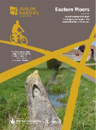 | Id: 715, Quality: 5Group: PublishedRouteLocation: GlastonburyPostcode: BA8 8LZMap Reference: 51.1406, -2.7074Ride length: 23 kmRide ease: EasyAdded by: Neil Wheadon | see Avalon Eastern Moors Ride https://avalonmarshes.org/explore/things-to-do/cycling/ This route explores the eastern marshes including Queen's Sedge Moor, Hearty Moor, Kennard Moor and the green fringes of the Isle of Avalon. |
 | Id: 695, Quality: 5Group: tcn2023Location: Stratford-upon-Avon RacecoursePostcode: CV37 9SEMap Reference: 52.1835, -1.73052Ride length: 52 kmAdded by: Neil Wheadon | Suggested day Places to eat Morning Coffee stop - Hatton Locks Lunch - Warwick Afternoon stop - Charlecote or Touchdown Cafe Places of interest Stratford armories - will take about 20 minutes Warwick - Castle, but that could take all day Charlecote (National Trust) There is plenty to see today as we ... |
 | Id: 693, Quality: 5Group: tcn2023Location: Stratford-upon-Avon RacecoursePostcode: CV37 9SEMap Reference: 52.1836, -1.73049Ride length: 57 kmRide ease: AverageAdded by: Neil Wheadon | Suggested Day Places to eat Morning stop - take a picnic to Samborne Lunch - Henley, cafes and picnic Afternoon stop - Yew Tree Farm Places to visit Coughton Court (National Trust) open after 11:00 Henley-in-Arden Henley may not seem an obvious target for a ride, but this small town has a charm of i ... |
 | Id: 690, Quality: 5Group: tcn2023Location: Stratford-upon-Avon RacecoursePostcode: CV37 9SEMap Reference: 52.1836, -1.73049Ride length: 66 kmRide ease: AverageAdded by: Neil Wheadon | Suggested Day Places to eat Morning stop - take a picnic to Samborne Lunch - Henley, cafes and picnic Afternoon stop - Yew Tree Farm Places to visit Coughton Court (National Trust) open after 11:00 Henley-in-Arden Henley may not seem an obvious target for a ride, but this small town has a charm of i ... |
 | Id: 688, Quality: 5Group: tcn2023Location: Stratford-upon-Avon RacecoursePostcode: CV37 9SEMap Reference: 52.1835, -1.73052Ride length: 70 kmRide ease: AverageAdded by: Neil Wheadon | Suggested day Places to eat Morning Coffee stop - New Inn and Community shop or Hatton Country World Lunch - Kenilworth Afternoon stop - Charlecote or Touchdown Cafe Places of interest Stratford armories - will take about 20 minutes Warwick - Castle, but that could take all day Kenilworth Castle (En ... |
 | Id: 616, Quality: 5Group: PublishedRouteLocation: Sturminster NewtonPostcode: DT10 1BNMap Reference: 50.9269, -2.30266Ride length: 20 kmRide ease: EasyAdded by: Neil Wheadon | This is the correct way that the North Dorset trailway runs (unlike the most popular Google search that is wrong on both ends, the path does not extend north of Sturminster Newton) Details at northdorsettrailway.org.uk The North Dorset Trailway now extends approximately 14 miles from Sturminster New ... |
 | Id: 547, Quality: 5Group: tcn2022Location: Corsham Rugby ClubPostcode: SN13 9QGMap Reference: 51.4311, -2.17137Ride length: 52 kmRide ease: EasyAdded by: Linda Stinchcombe | This ride passes through the pretty little village of Biddestone with its village green and picturesque duck pond, before heading on to the quintessentially English village of Castle Combe which has featured regularly as a film location including The Wolf Man, War Horse and the original Dr Doolittle ... |
 | Id: 546, Quality: 5Group: tcn2022Location: Corsham Rugby ClubPostcode: SN13 9QGMap Reference: 51.4311, -2.17137Ride length: 78 kmRide ease: AverageAdded by: Linda Stinchcombe | This ride passes through the pretty little village of Biddestone with its village green and picturesque duck pond, before heading on to the quintessentially English village of Castle Combe which has featured regularly as a film location including The Wolf Man, War Horse and the original Dr Doolittle ... |
 | Id: 544, Quality: 5Group: tcn2022Location: Corsham Rugby ClubPostcode: SN13 9QGMap Reference: 51.4311, -2.17132Ride length: 43 kmRide ease: EasyAdded by: Linda Stinchcombe | This ride passes through the pretty little village of Biddestone with its village green and picturesque duck pond, before continuing through the historic market town of Chippenham. From there, you'll take the old railway path to Calne. Although definitely passable (we did it at its muddiest on our t ... |
 | Id: 542, Quality: 5Group: tcn2022Location: Corsham Rugby ClubPostcode: SN13 9QGMap Reference: 51.4312, -2.17162Ride length: 106 kmRide ease: HardAdded by: Linda Stinchcombe | This ride initially heads for Trowbridge, the county town of Wiltshire with a rich industrial heritage. Shortly after passing through Trowbridge you'll loop out to the east through a number of Wiltshire villages before arriving in Bratton where you'll take the fabulous climb up on to the Wessex Ridg ... |