 |
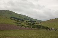
Id: 1060, Quality: 5Group: tcn2024Location: Alnwick Rugby Football Club, Greensfield, Willowburn Avenue, AlnwickPostcode: NE66 1BEMap Reference: 55.4025, -1.69862Ride length: 118 kmRide ease: HardAdded by: Joseph Bulloch | A scenic ride with views to the Cheviot Hills, north to Chillingham Castle and Etal Village and return via Wooler and Ingram in the beautiful Breamish Valley before returning to Alnwick. In detail: Eglingham, Chillingham, Chatton, Doddington, Ford, Etal (Cafes) Kirknewton, Wooler (cafes) Ingram (Caf ... |
 |
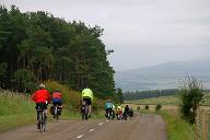
Id: 1059, Quality: 5Group: tcn2024Location: Alnwick Rugby Football Club, Greensfield, Willowburn Avenue, AlnwickPostcode: NE66 1BEMap Reference: 55.4023, -1.69862Ride length: 80 kmRide ease: AverageAdded by: Joseph Bulloch | A scenic ride with views to the Cheviot Hills, north to Chillingham Castle and Wooler then to Ingram in the beautiful Breamish Valley before returning to Alnwick. In detail: Eglingham, Chillingham, Chatton, Wooler (Cafes), Ingram (Cafe) Powburn, Alnwick Warning: There are fords at 22.5 and 40.4 mile ... |
 |
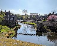
Id: 1058, Quality: 5Group: tcn2024Location: Alnwick Rugby Football Club, Greensfield, Willowburn Avenue, AlnwickPostcode: NE66 1BEMap Reference: 55.4025, -1.69868Ride length: 64 kmRide ease: EasyAdded by: Joseph Bulloch | A scenic ride with views to the Cheviot Hills, north to Chillingham Castle and then to Ingram in the beautiful Breamish Valley before returning to Alnwick. In detail: Eglingham, Chillingham Castle (cafe) Ingram (Cafe), Powburn, Alnwick Warning: There are fords at 15.6 and 30.2 miles. There are pedes ... |
 |
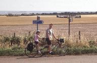
Id: 1057, Quality: 5Group: tcn2024Location: Alnwick Rugby Football Club, Greensfield, Willowburn Avenue, AlnwickPostcode: NE66 1BEMap Reference: 55.4025, -1.69862Ride length: 102 kmRide ease: HardAdded by: Joseph Bulloch | South along the coast through Warkworth, Amble, Druridge Bay and returning inland via Widdrington, Linton, Morpeth, Pigdon. Netherwitton, Pauperhaugh, Felton, Acklington and Shillbottle to Alnwick In detail: Warkworth, Amble, Druridge, (possibly Cresswell (Drift Cafe or village shop, public toilets ... |
 |
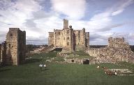
Id: 1056, Quality: 5Group: tcn2024Location: Alnwick Rugby Football Club, Greensfield, Willowburn Avenue, AlnwickPostcode: NE66 1BEMap Reference: 55.4025, -1.69862Ride length: 80 kmRide ease: AverageAdded by: Joseph Bulloch | South along the coast through Warkworth, Amble, Druridge Bay and returning inland via Widdrington, Linton, Morpeth, Hebron, Tritlington, Acklington and Shillbottle to Alnwick. In detail: Warkworth, Amble, Druridge, (possibly Cresswell (Drift Cafe or village shop, public toilets in village, beach) Wi ... |
 |
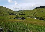
Id: 1055, Quality: 5Group: tcn2024Location: Alnwick Rugby Football Club, Greensfield, Willowburn Avenue, AlnwickPostcode: NE66 1BEMap Reference: 55.4025, -1.69862Ride length: 52 kmRide ease: EasyAdded by: Joseph Bulloch | South along the coast through Warkworth, Amble and Druridge Bay and returning inland via Widdrington, Acklington and Shilbottle to Alnwick. In detail: Warkworth, Amble, Druridge, (possibly Cresswell (Drift Cafe or village shop, public toilets in village, beach) Widdrington, Acklington, Shillbottle. ... |
 |
Id: 1054, Quality: 5Group: tcn2024Location: Alnwick Rugby Football Club, Greensfield, Willowburn Avenue, AlnwickPostcode: NE66 1BEMap Reference: 55.4025, -1.69869Ride length: 111 kmRide ease: HardAdded by: Joseph Bulloch | A hilly ride via Rothbury to explore the Upper Coquet valley from Alwinton with the reward of extensive open views towards the Simonside and Cheviot Hills returning to Alnwick via Whittingham In detail: Rothbury, Whitton, Tosson, Harbottle, Alwinton (Pub), then out and back up Coquet Valley to Chew ... |
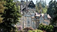 |
Id: 1052, Quality: 5Group: tcn2024Location: Alnwick Rugby Football Club, Greensfield, Willowburn Avenue, AlnwickPostcode: NE66 1BEMap Reference: 55.4026, -1.69868Ride length: 49 kmRide ease: AverageAdded by: Joseph Bulloch | A hilly ride to Rothbury with the reward of extensive views to the Simonside and Cheviot Hills. Places to visit Rothbury:- Cragside, National Trust, Thropton, Cartington, Whittingham |
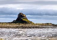 |
Id: 1051, Quality: 5Group: tcn2024Location: Alnwick Rugby Football Club, Greensfield, Willowburn Avenue, AlnwickPostcode: NE66 1BEMap Reference: 55.4026, -1.69868Ride length: 117 kmRide ease: HardAdded by: Joseph Bulloch | North along the coast through small villages to Beadnell, Seahouses, Bamburgh, Belford and Beal to Holy Island (if tide times permit) returning to Waren Mill and then inland via Lucker and Rock to Alnwick. |
 |
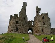
Id: 1050, Quality: 5Group: tcn2024Location: Alnwick Rugby Football Club, Greensfield, Willowburn Avenue, AlnwickPostcode: NE66 1BEMap Reference: 55.4025, -1.69868Ride length: 81 kmRide ease: AverageAdded by: Joseph Bulloch | North along the coast through small villages to Craster, Beadnell and Bamburgh and returning inland to Alnwick. In detail: Alnmouth, NCN 1 to Boulmer, Longhoughton (cafe), Craster (Cafe), Beadnell, continue on NCN 1 to Bamburgh, back via Warren Mill, Lucker |
 |
Id: 1049, Quality: 5Group: tcn2024Location: Alnwick Rugby Football Club, Greensfield, Willowburn Avenue, AlnwickPostcode: NE66 1BEMap Reference: 55.4026, -1.69868Ride length: 61 kmRide ease: EasyAdded by: Joseph Bulloch | Su_S_38m_NorthCoast - Orriginal Rally name North along the coast through small villages to Craster and Beadnell and returning inland to Alnwick. In detail: Alnmouth, NCN 1 to Boulmer, Longhoughton (cafe), Craster (Cafe), Beadnell, Chathill, Denwick, Alnwick |
 |
Id: 1053, Quality: 4Group: tcn2024Location: Alnwick Rugby Football Club, Greensfield, Willowburn Avenue, AlnwickPostcode: NE66 1BEMap Reference: 55.4026, -1.69868Ride length: 73 kmRide ease: AverageAdded by: Joseph Bulloch | A hilly ride via Rothbury to the Coquet valley with the reward of extensive open views towards the Simonside and Cheviot Hills returning to Alnwick via Whittingham In detail: Rothbury, Whitton, Tosson, Harbottle, Alwinton (Pub), Netherton, Whittingham, Alnwick |

