
Account
Pictures
Tandem Club GPX/TCX Rides list
 |
Id: 246, Quality: 5 Group: rides Location: Derbyshire Map Reference: 53.1093, -1.5592 Ride length: 9 km Ride ease: Hard Added by: Noel Hughes | An alternative loop from Cromford up the Sheep Pastures and Middleton Inclines which rejoins the main Mills and Dales route at the top of Hopton Incline. Please refer to the Route Sheet for full details. |
|
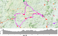
Id: 245, Quality: 5 Group: rides Location: Derbyshire Map Reference: 53.1435, -1.74441 Ride length: 44 km Ride ease: Average Added by: Noel Hughes | A 28 mile (45km) ride through some of the historic sections of the Peak District's industrial past. Please refer to the Route Sheet for full details. |
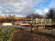 |
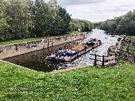
Id: 1878, Quality: 4 Group: rides Location: Selby Postcode: YO8 4PL Map Reference: 53.7847, -1.06499 Ride length: 9 km Ride ease: Average Added by: Neil Wheadon | Good surface from Selby to Brayton Bridge but Brayton Bridge to West Haddlesey is not great. See https://waterways.org.uk/waterways/discover-the-waterways/selby-canal The Selby Canal was built in the 1770s when the Aire and Calder Canal Company became aware of rumours that a canal was to be construc ... |
 |
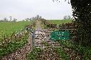
Id: 1876, Quality: 4 Group: rides Location: Methley, Postcode: LS26 9ET Map Reference: 53.7409, -1.40489 Ride length: 13 km Ride ease: Easy Added by: Neil Wheadon | Good surfaced trail throughout. There is a stair flight to negotiate at Skelton Grange Bridge. Two cafes at Methley. The Greenhouse, Station Road and Rivers Meet, Leeds Road. Also Piglove bar next to the river on the approach to Leeds. |
 |
Id: 1063, Quality: 2 Group: rides Location: Llethrau Forest and Nature Retreats, Felindre, Knighton, Powys Postcode: LD7 1YT Map Reference: 52.4438, -3.26283 Ride length: 84 km Ride ease: Hard Added by: Neil Wheadon | We start from Llethrau and head to Knighton entering via the minor road to the North. There are several cafes in Knighton and a clock tower as well as the Offas Dyke centre. We shall have a coffee break here. We head south west through Knucklas and its victorian viaduct, heading towards Llandrindod ... |
|
Id: 436, Quality: 2 Group: rides Location: Isle of Wight Postcode: BA3 5LS Map Reference: 50.7579, -1.28956 Ride length: 106 km Ride ease: Average Added by: Neil Wheadon | |
|
Id: 281, Quality: 2 Group: rides Location: Peak District Map Reference: 53.1203, -1.8576 Ride length: 38 km Ride ease: Average Added by: Noel Hughes | This route starts and finishes in the Manifold Valley close to the former Ecton Copper Mines and Ecton Creamery (OS Ref: SK 096 581 What3words: ///boldest.drilling.forensic) and follows sections of three disused former Peakland railway tracks; the Leek & Manifold Light Railway, The Cromford and High ... |
|
Id: 223, Quality: 2 Group: rides Location: BA3 5LS Postcode: BA3 5LS Map Reference: 54.4461, -2.45598 Ride length: 68 km Added by: Neil Wheadon |