
Account
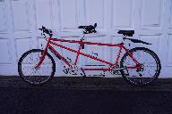
Pictures

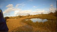
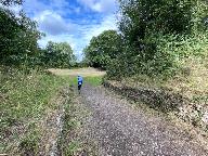
Tandem Club GPX/TCX Rides list
 |
Id: 1946, Quality: 4 Group: Thameswey Location: Tadley Postcode: RG26 3JE Map Reference: 51.3571, -1.13994 Ride length: 36 km Added by: Robert Bending | Medium ride of 22.5 miles. The route starts and finishes in Tadley at the Sainsburys car park, but equally could start at Silchester where there is parking next to the playing field. Another start/finish point could be the Queen's College Arms at Pamber End, but parking would be limited to the pub c ... |
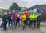 |
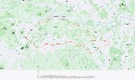
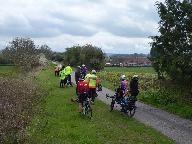
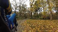
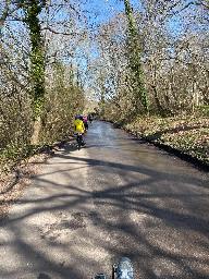
Id: 1858, Quality: 4 Group: Thameswey Map Reference: 51.7534, -1.09125 Ride length: 43 km Added by: Pauline Casey | Ride Report On Saturday, 17 January 2026, 10 intrepid souls from the Thameswey chapter of the Tandem Club joined first-time ride leaders Jan and Paul on a 27-mile jaunt around the Oxford countryside. First though, a big thank you to @Martin Casey for creating the route for us. Six tandems set off fr ... |
 |
Id: 1838, Quality: 4 Group: Thameswey Location: Ball Hill, near Newbury Postcode: GU,OX,RG,SL Map Reference: 51.3669, -1.38515 Ride length: 44 km Added by: Robert Bending | A medium 27 mile ride with just over 1,600 feet of climbing. Starting at the Yew Tree Garden Centre, Ball Hill near Newbury. Nice cafe in the Garden Centre. The ride heads in a westerly direction along country lanes below the ridge of Walbury Hill and Combe Gibbet as far as Great Bedwyn, then turns ... |
 |
Id: 1423, Quality: 4 Group: Thameswey Location: Tadley Postcode: RG26 3JE Map Reference: 51.3562, -1.14162 Ride length: 40 km Added by: Robert Bending | An easy ride starting at the Starbucks Cafe in Sainsbury''s in Tadley (30a Mulfords Hill, Tadley RG26 3JE). Take care crossing the A340, both at the roundabout at the end of Rowan Road and Pamber End by the Queens College Arms. You can choose to take the short 'spur' along Green Lane to the Wellingt ... |
 |
Id: 1380, Quality: 4 Group: Thameswey Location: Thatcham Postcode: Thatcham Map Reference: 51.3825, -1.2844 Ride length: 39 km Ride ease: Average Added by: Robert Bending | Just over 20 miles to the Swan at Newtown (https://www.swannewbury.co.uk) booking for popular times advised - and about 4.5 to return to Greenham Common Control Tower. Parking at the Control Tower (height restriction on entrance). Cafe in the Control Tower and a small museum on upper floors (https:/ ... |
 |
Id: 1158, Quality: 4 Group: Thameswey Location: Eynsham Postcode: OX29 4HA Map Reference: 51.7803, -1.37357 Ride length: 38 km Ride ease: Hard Added by: Robert Bending | Starting in Eynsham, west of Oxford and Blenheim Palace. There is a free public car park a short way from the town centre where there are cafes for a pre-ride carb boost. Surfaces are all tarmac though some of the smaller lanes have rough surfaces. This ride ramps up with some relatively stiff climb ... |
 |
Id: 1107, Quality: 4 Group: Thameswey Location: GU,OX,RG,SL Postcode: GU,OX,RG,SL Map Reference: 51.3567, -1.13998 Ride length: 43 km Ride ease: Easy Added by: Robert Bending | About 27 miles in all, starting at the Sainsbury's car park (Starbucks Cafe in Sainsbury's) this will take you through Tadley, past the golf course to Baughurst then along relatively quiet lanes to Sherborne St. John. Take care crossing the A340 here. Next leg takes you past the Vyne National Trust. ... |
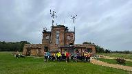 |
Id: 742, Quality: 4 Group: Thameswey Location: GU,OX,RG,SL Postcode: GU,OX,RG,SL Map Reference: 51.3811, -1.28202 Ride length: 43 km Ride ease: Average Added by: Robert Bending | Starts at the Greenham Control Tower: The upper floors are usually open with a permanent exhibition and access to the control room with views over the common and to the hills beyond. Well worth spending a little time here, especially if you don't know the significance of Greenham Common when it was ... |
 |
Id: 687, Quality: 4 Group: Thameswey Location: GU,OX,RG,SL Postcode: GU,OX,RG,SL Map Reference: 51.7527, -1.09118 Ride length: 54 km Ride ease: Average Added by: Robert Bending | A 34 mile ride from Waterperry Gardens heading east towards Princes Risborough by way of the Pheonix Trail, but turning south before reaching the town, bypassing Watlington then returning via Great Milton. Mostly flatish with a couple of hills near the middle of the route. Plenty of pubs along the w ... |
 |
Id: 435, Quality: 4 Group: Thameswey Location: Tadley, Hampshire Postcode: RG Map Reference: 51.357, -1.13984 Ride length: 38 km Ride ease: Average Added by: Robert Bending | Ride starts and finishes at Sainsbury's in Tadley. Not a particularly long ride at around 23 miles but there are a few climbs. Hannington is the highest point of the ride and there's a pub (The Vine) or the village green to stop and take a break. One shortish climb after Hannington up Plantation Hil ... |
|
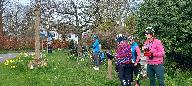
Id: 1995, Quality: 3 Group: Thameswey Location: Hatt Common, East Woodhay, Newbury Postcode: RG20 0NG Map Reference: 51.3667, -1.38456 Ride length: 36 km Ride ease: Easy Added by: Neil Wheadon | Claire & Anne-Marie and I are leading their first ride on Saturday 21st March. Meet at Yew tree Garden Centre at 0945 for pre ride refreshments. The Garden centre opens at 9am. We will aim to leave at 1015 to start the ride. The address for Yew Tree Garden centre is: Hatt Common, East Woodhay, Newbu ... |
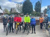 |
Id: 1001, Quality: 3 Group: Thameswey Location: Wallingford Postcode: OX10 6SJ Map Reference: 51.6188, -1.1122 Ride length: 40 km Added by: Neil Wheadon | Nice ride out with the Thameswey group of the Tandem Club yesterday (21st Apr). Cold wind was a bit mean in places. Route was planned by Peter & Shirley but injury meant they were unable to ride to Martin & Pauline took over to lead the ride. Started at the popular and busy Waterside cafe at Benson. ... |
 |
Id: 904, Quality: 3 Group: Thameswey Location: BA3 5LS Postcode: BA3 5LS Map Reference: 52.1027, -1.91785 Ride length: 54 km Added by: Neil Wheadon | |
 |
Id: 903, Quality: 3 Group: Thameswey Location: BA3 5LS Postcode: BA3 5LS Map Reference: 52.1027, -1.91768 Ride length: 52 km Ride ease: Easy Added by: Neil Wheadon | |
 |
Id: 902, Quality: 3 Group: Thameswey Location: BA3 5LS Postcode: BA3 5LS Map Reference: 52.1027, -1.9178 Ride length: 26 km Ride ease: Easy Added by: Neil Wheadon | |
|
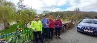
Id: 2025, Quality: 2 Group: Thameswey Map Reference: 51.9384, -1.83442 Ride length: 55 km Added by: Stuart Hibberd | A ride through one of the prettiest parts of the Cotswolds. Starting from the Cotswold Farm Park, going south through The Slaughters. back north for lunch at Snowshill, then through the picturesque villages of Chipping Campden and Blockley. Returning to the Farm Park for Afternoon tea. Please note t ... |
 |
Id: 2004, Quality: 2 Group: Thameswey Location: GU,OX,RG,SL Postcode: GU,OX,RG,SL Map Reference: 51.3672, -1.38505 Ride length: 37 km Ride ease: Average Added by: Robert Bending | A relatively easy 23 mile ride with some easy climbs. Mostly narrow, quiet lanes. Plenty of shops, cafes and pubs in Hungerford for a mid-way stop. Loops at the end of the ride could be left out to reduce the distance a little. Ride starts at Yew Tree Garden Centre, Ball Hill but could equally start ... |
|
Id: 1947, Quality: 2 Group: Thameswey Location: GU,OX,RG,SL Postcode: GU,OX,RG,SL Map Reference: 51.3571, -1.13994 Ride length: 36 km Added by: Robert Bending | Medium ride of 22.5 miles. The route starts and finishes in Tadley at the Sainsburys car park, but equally could start at Silchester where there is parking next to the playing field. Another start/finish point could be the Queen's College Arms at Pamber End, but parking would be limited to the pub c ... |
|
Id: 1880, Quality: 2 Group: Thameswey Map Reference: 51.3571, -1.13994 Ride length: 37 km Added by: Pauline Casey | Please find attached the .gpx and menu files for our ride, Sunday 15th Feb. Link to RideWithGPS - https://ridewithgps.com/routes/53652724 Meet at the Starbucks, Sainsbury's in Tadley - open 8.00am til 4.00pm. Karon and Bob will be there from about 9.30am. Please park away from the shop in the car pa ... |
 |
Id: 1839, Quality: 2 Group: Thameswey Location: Ball Hill, near Newbury Postcode: GU,OX,RG,SL Map Reference: 51.3669, -1.38515 Ride length: 44 km Added by: Robert Bending | A medium 27 mile ride with just over 1,600 feet of climbing. Starting at the Yew Tree Garden Centre, Ball Hill near Newbury. Nice cafe in the Garden Centre. The ride heads in a westerly direction along country lanes below the ridge of Walbury Hill and Combe Gibbet as far as Great Bedwyn, then turns ... |