
Account
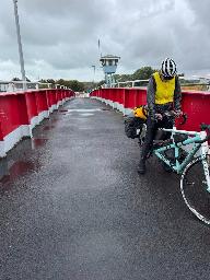
Pictures
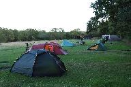
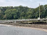
Builders sample in la Mare Giffard
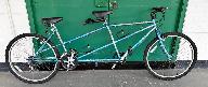
Tandem Club GPX/TCX Rides list
 |
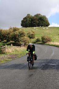
Id: 1804, Quality: 4 Group: Other Location: Chichester Postcode: PO19 3QR Map Reference: 50.8357, -0.807502 Ride length: 118 km Added by: Neil Wheadon | Snails round Britain day 67 to Eastbourne |
 |
Id: 1803, Quality: 4 Group: Other Location: Bournemouth Postcode: BH5 1HJ Map Reference: 50.7261, -1.83492 Ride length: 113 km Added by: Neil Wheadon | Snails round Britain day 66 to Fishbourne (5 days to go) |
 |
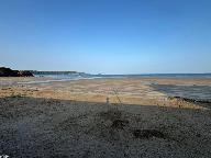
Id: 1801, Quality: 4 Group: Other Location: Llanmartin Postcode: NP18 2EB Map Reference: 51.6008, -2.87525 Ride length: 88 km Added by: Neil Wheadon | Snails round Britain day 54 to Weston-super-Mare |
 |
Id: 1800, Quality: 4 Group: Other Location: Port Talbot Postcode: SA13 2PL Map Reference: 51.5355, -3.7234 Ride length: 111 km Added by: Neil Wheadon | |
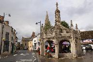 |
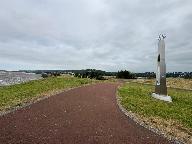
Id: 1797, Quality: 4 Group: Other Location: Malmesbury Postcode: SN16 9BG Map Reference: 51.5832, -2.09666 Ride length: 17 km Ride ease: Easy Added by: Neil Wheadon | Malmesbury is the oldest borough in England, with a charter given by Alfred the Great around 880. Therefore it is worth taking time to explore this lovely Wiltshire town. The Aethelstan Museum details the towns history, whilst the impressive Abbey started in the 12th century can still be visited, a ... |
 |
Id: 1796, Quality: 4 Group: Other Location: Callow Hill Postcode: SN15 5DZ Map Reference: 51.5628, -1.95029 Ride length: 14 km Added by: Neil Wheadon | Starting at the crossroads at Callow Hill, you pass through pretty tree lined lanes towards Malmesbury. There are few turns initially, with a gentle downhill this is lovely easy cycling. Passing through Garsden you will eventually end up on the outskirts of Malmesbury, where you enter from the west, ... |
 |
Id: 1795, Quality: 4 Group: Other Location: Clyffe Pypard Postcode: SN4 7PY Map Reference: 51.4899, -1.89773 Ride length: 11 km Ride ease: Average Added by: Neil Wheadon | There isn't really an obvious start place for this section, it is just after the right turn to Clyffe Pypard if coming from Broad Hinton.Head for Bushton. It's also pretty non descript section Through the lanes to Tockenham after which there is a tricky section across an A road. It's quite a fast ro ... |
 |
Id: 1794, Quality: 4 Group: Other Location: Malborough Postcode: SN8 1HF Map Reference: 51.4185, -1.73382 Ride length: 16 km Ride ease: Hard Added by: Neil Wheadon | Having explored Malborough, near the western end of the widest high street in England lies the start of this section next to the library. Head up the narrow lane that has more cars than you would expect, climbing towards the rugby club grounds where you will head left for the start of the longest cl ... |
 |
Id: 1793, Quality: 4 Group: Other Location: Burry Port Postcode: SA16 0HL Map Reference: 51.6833, -4.26182 Ride length: 106 km Added by: Neil Wheadon | Snails round Britain tandem tour day 52 |
 |
Id: 1792, Quality: 4 Group: Other Location: Tenby Postcode: SA70 8QD Map Reference: 51.6561, -4.80836 Ride length: 73 km Added by: Neil Wheadon | Snails round Britain tandem tour day 51 to Burry Port Wales day 9 |
 |
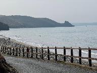
Id: 1791, Quality: 4 Group: Other Location: Broad Haven Postcode: SA62 3JR Map Reference: 51.7793, -5.10312 Ride length: 79 km Added by: Neil Wheadon | Snails around Britain tandem tour day 50 to Jameston nr Tenby Wales day 8 Massive thanks to Caroline and Steve for putting us up! |
 |
Id: 1790, Quality: 4 Group: Other Location: Fishguard Postcode: SA65 9AR Map Reference: 51.9929, -4.97832 Ride length: 52 km Added by: Neil Wheadon | Snails round Britain tandem ride day 49 to Broad Haven Wales day 7 |
 |
Id: 1788, Quality: 4 Group: Other Location: Aberystwyth Postcode: SY23 1QD Map Reference: 52.4122, -4.0857 Ride length: 90 km Added by: Neil Wheadon | Snails around Britain tandem tour day 48 to Abergwuan (Fishguard) Wales day 6 - A day of reflection. Instead of Cardigan we went further to Fishguard. Some of the climbs were rather steep >20% but it leaves us with a shorter day tomorrow morning. |
 |
Id: 1787, Quality: 4 Group: Other Location: Porthmadog Postcode: LL49 9NF Map Reference: 52.9243, -4.12619 Ride length: 113 km Added by: Neil Wheadon | Snails around Britain tandem tour, day 47 to Aberystwyth Wales day 5 |
 |
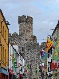
Id: 1786, Quality: 4 Group: Other Location: Caernarfon Postcode: LL54 5RR Map Reference: 53.1393, -4.28325 Ride length: 114 km Added by: Neil Wheadon | Snails around Britain tandem tour day 46 to Porthmadog Wales day 4 |
 |
Id: 1785, Quality: 4 Group: Other Location: Amlwch Postcode: LL68 9SA Map Reference: 53.4207, -4.36778 Ride length: 97 km Added by: Neil Wheadon | Snails around Britain tandem tour day 45 to Caernarfon Wales day 3 |
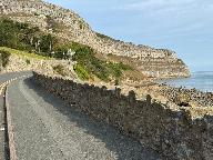 |
Id: 1784, Quality: 4 Group: Other Location: Llandudno Postcode: LL30 1BD Map Reference: 53.322, -3.8154 Ride length: 97 km Added by: Neil Wheadon | Snails around Britain tandem tour day 44 to Bull Bay, Anglesey Wales day 2 |
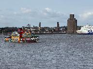 |
Id: 1783, Quality: 4 Group: Other Location: Liverpool Postcode: L8 5RE Map Reference: 53.3928, -2.98092 Ride length: 111 km Added by: Neil Wheadon | Snails around Britain tandem tour day 43 to Llandudno Wales day 1 |
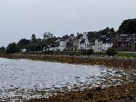 |
Id: 1774, Quality: 4 Group: Other Location: BA3 5LS Postcode: BA3 5LS Map Reference: 56.2283, -5.0759 Ride length: 99 km Added by: Neil Wheadon | Snails around Britain day 34 to Seamill, West Kilbride Day 23 in Scotland |
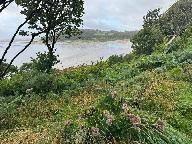 |
Id: 1773, Quality: 4 Group: Other Location: Dalbeattie Postcode: DG5 4HA Map Reference: 54.9323, -3.82138 Ride length: 114 km Added by: Neil Wheadon | Snails around Britain tandem tour day 38 in storm Floris. 27th and final day in Scotland |