
View Item

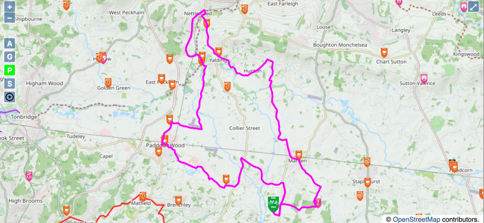
The second part is the map (and elevation) There is a lot of potential information here. The route is shown in pink. The start point is the Green Tandem Icon. On the map you will see various icons, there are over 50 different catagories. Orange is places to ear, pink is places of interest, purple places to stay, green, cycle related (bike shops) Brown is travel information. If you click on any of these you will get lots of information, a description, URL about it, a picture etc. Therefore the night before you can look at where you are passing close to. On the left are various buttons. +/- zoom in and out. A - This gives an photographic aerial view G - The default mapping is Open Street View, you can look at it on a google map. P - This takes away all the icons, so you can look at the map . S - This is clever. If pressed it brings up all the icon catagories and you can select the ones you are interested in, so if you want a castle, you can select for just this, try it. THE TARGET/DOT. This is really useful whilst on the rally. If you activate this and have Rides on the phone, this dot will show you where you are on the route (and how close you are to that cafe) All these icons have been hand done, there are over 10.000 country wide