
Account
Pictures
Tandem Club GPX/TCX Rides list
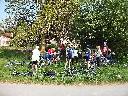
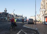
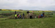
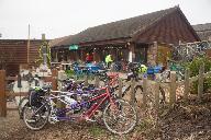
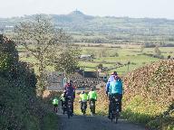
As a club we have many organised rides including national and international large events as well as local regional group rides. Quite a few of these have been made available to members using route sheets and more recently GPX/TCX files for sat navs. This is a database of all of these rides allowing you to view and download GPX/TCX files and route sheets where available.
We are slowly adding all of our rides to this database. If any member is willing to help that would be great ! These rides are provided on an as is basis if you ride them you do so entirely at your own risk. The Club, its officers and ride organisers accept no responsibility for loss, damage to property, accident, injury or death, that may occur, however caused, whether by negligence, deliberate act or otherwise. Any RO/member can add rides to make it easy for members to access them.
You can add rides using the Add Ride link. You must have a website login account to do this.By default the Selection criteria will be for rides in your own group. Set this to "All" to list all rides and click on the "Search" button. Some assistance with using this system is at: Help. You can just view and add places of interest using PlaceList. Note that when you have added a ride you can view it with a background map and proceed to add places of interest. This system is still a work in progress. Please feedback issues/ideas to: webgroup@tandem-club.org.uk.
 | Id: 428, Quality: 5Group: WestCountryLocation: Chipping SodburyPostcode: BS37 6ADMap Reference: 51.5382, -2.39483Ride length: 37 kmRide ease: AverageAdded by: Terry Barnaby | This ride is perfect for a winter day and the West Country group did this in November 2021...enjoy Starting in the pretty Market town of Chipping Sobury, the ride heads north crossing Horton Common with extensive views. You will pick up the Avon Cycleway as the route heads west to Rangeworthy and th ... |
 | Id: 344, Quality: 5Group: WestCountryLocation: RadstockPostcode: BA3 3GBMap Reference: 51.2916, -2.44884Ride length: 19 kmRide ease: AverageAdded by: Neil Wheadon | From Radstock to Bath, via the Two Tunnels along Route 24 |
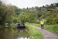 | Id: 318, Quality: 5Group: WestCountryLocation: BathPostcode: BA1 3JNMap Reference: 51.3853, -2.40019Ride length: 69 kmRide ease: AverageAdded by: Neil Wheadon | Starting at the end of the Bath Bristol Cycletrack this ride takes you out of Bath along route 24 through the Two Tunnels towards Wellow. Doubling back you'll head through Monkton Coombe to access the towpath of the Kennet and Avon Canal to ride along the wide path to Bradford-on-Avon (The 2 tunnels ... |
 | Id: 298, Quality: 5Group: WestCountryLocation: MellsPostcode: BA11 3PFMap Reference: 51.2397, -2.38789Ride length: 36 kmRide ease: AverageAdded by: Neil Wheadon | This very diverse route starts in the pretty village of Mells. It heads through Great Elm and into Frome. There are a few climbs in this section (until the railway path is completed in a few years) Through the outskirts of Frome to exit on a purpose built path. Care as you cross a fast road and into ... |
 | Id: 940, Quality: 4Group: WestCountryLocation: CharfieldPostcode: GL12 8TGMap Reference: 51.6286, -2.40183Ride length: 55 kmRide ease: HardAdded by: Neil Wheadon | Meet at Charfield Village Hall Wotton Rd, Charfield, Wotton-under-Edge. GL12 8TG at 09:30 - no official parking in Charfield so suggest TC members simply find somewhere in the village suitable on the day. map Caf? at Charfield open from 9am if anyone wants to grab a quick pre-ride drink. Morning cof ... |
 | Id: 876, Quality: 4Group: WestCountryLocation: 3 Cathedral Ave, WellsPostcode: BA5 1FDMap Reference: 51.2017, -2.64857Ride length: 54 kmAdded by: Neil Wheadon | Starting from the southern edge of Wells, we pick up Sustrans route 3 as it heads east. Part of the Mendip Ring, this will hopefully connect to Shepton Mallet in the coming years as it follows the former railway line. There are a number of ways to Glastonbury and this route takes the recommended cyc ... |
 | Id: 869, Quality: 4Group: WestCountryLocation: Flax BourtonPostcode: BS48 3QTMap Reference: 51.4252, -2.68222Ride length: 43 kmRide ease: AverageAdded by: Neil Wheadon | |
 | Id: 856, Quality: 4Group: WestCountryLocation: Bristol Golf Course, St. Swithins Park, Blackhorse Hill, Almondsbury, Bristol Postcode: BS10 7TPMap Reference: 51.5318, -2.60015Ride length: 33 kmRide ease: AverageAdded by: Neil Wheadon | A lovely ride that the West Country group did in December 2023 The weather was about 10 degrees so pretty good for the time of year The first half of the ride took in many cyclepaths to reach the Severn Estuary There was one longer climb towards the end |
 | Id: 736, Quality: 4Group: WestCountryLocation: Worcester Postcode: WR8 0EEMap Reference: 52.0948, -2.27402Ride length: 49 kmAdded by: Stuart Hibberd | Sunday ride. Starting from Blackmoor Camping and Caravaning Club site. 2, Hanley Swan, Worcester WR8 0EE. map |
 | Id: 735, Quality: 4Group: WestCountryLocation: WorcesterPostcode: WR8 0EEMap Reference: 52.0971, -2.27575Ride length: 63 kmAdded by: Stuart Hibberd | Saturday medium ride. Starting from Blackmoor Camping and Caravaning Club site. 2, Hanley Swan, Worcester WR8 0EE. There will be a choice of two rides both heading out first to explore the cathedral city of Worcester, the shorter ride of circa 47km looping back to the camp site and with the slightly ... |
 | Id: 640, Quality: 4Group: WestCountryLocation: WellsPostcode: BA5 1FDMap Reference: 51.2017, -2.64877Ride length: 54 kmAdded by: Neil Wheadon | This ride starts at Shepton Vets, Wells branch. Parking has been especially arranged, so if you are doing this route at a later date, there is street parking reasonably close. (The vets work 6 days a week) Starting from Wells the ride starts along the former Wells to Shepton Mallet railway line whic ... |
 | Id: 590, Quality: 4Group: WestCountryLocation: ThornburyPostcode: BS35 2ATMap Reference: 51.6072, -2.52327Ride length: 58 kmAdded by: Terry Barnaby | Meet at Rock Street car park Thornbury BS35 2FH at 09:30 (Use Long Stay section) BEWARE of HEIGHT BARRIER at Car Park Entrance map Ride to the Black Shed at Slimbridge via Hideout Lounge, Tortworth for coffee. |
 | Id: 582, Quality: 4Group: WestCountryLocation: RadstockPostcode: BA3 3AAMap Reference: 51.2933, -2.44794Ride length: 68 kmRide ease: AverageAdded by: Neil Wheadon | Starting at Radstock, you set out along the Norton Radstock Greenway before taking the gentle but long climb to the western edge of Chilcompton. A lane lined by farms leads to Chewton Mendip where there is a cafe stop at Lynd's Loaf. There isn't a great deal of seating here, but she bakes. Another l ... |
 | Id: 492, Quality: 4Group: WestCountryLocation: BadmintonPostcode: GL9 1DGMap Reference: 51.5426, -2.28564Ride length: 46 kmRide ease: EasyAdded by: Neil Wheadon | A ride noted for it's flatness in the Cotswolds. Put together by Simon who rides this area on a regular basis, it takes in the pretty town of Tetbury, made famous by Prince Charles and other royals to loop through Sherston |
 | Id: 349, Quality: 4Group: WestCountryLocation: HambrookPostcode: BS16 1SJMap Reference: 51.5112, -2.5106Ride length: 64 kmAdded by: Jackie and Stuart Hibberd | This is a lovely ride along the lanes north of Yate The outward lanes heading towards Luckington uses roads that are surprisingly quiet considering the area and you can hear the M4 to your left. Care when crossing the A46 north of Pensylvania but the subsequent gradual drop along a quiet lane is gl ... |
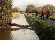
 | Id: 310, Quality: 4Group: WestCountryLocation: Severn BeachPostcode: BS35 4PQMap Reference: 51.5615, -2.66305Ride length: 56 kmRide ease: AverageAdded by: Neil Wheadon | Hurrah! Route for our first post-lockdown local ride Sat 10 April attached as pdf map and gpx route. 36 miles, going anti-clockwise. With pubs, cafes etc still closed the constraint is lack of public toilets. One big hill up from Tockington to A38. Bring a picnic lunch. Note: New Passage - Severn B ... |
 | Id: 254, Quality: 4Group: WestCountryLocation: Wells, SomersetPostcode: BA5 1SQMap Reference: 51.2035, -2.64947Ride length: 38 kmRide ease: EasyAdded by: Neil Wheadon | Starting from the south side of Wells, close to Morrisons Supermarket, this ride heads west across the Somerset levels, an ancient landscape where King Alfred hid after being attacked by the Danes to subsequently build an army and retake Wessex. The ride twists and turns the waterways to finally arr ... |
 | Id: 6, Quality: 4Group: WestCountryLocation: BathMap Reference: 51.3814, -2.38815Ride length: 47 kmRide ease: AverageAdded by: Stuart Hibberd | A good ride out to the Faulkland for lunch. We had to cope with ice and floods but made it in the end. |
 | Id: 686, Quality: 3Group: WestCountryLocation: Flax BourtonPostcode: BS48 3QTMap Reference: 51.4255, -2.6813Ride length: 54 kmAdded by: Stuart Hibberd | Meet at 09:30 for coffee at the Greedy Goose Gatcombe Farm Shop, Flax Bourton. BS48 3QT. Ride starts at 10:00. map Ride to The Plough Inn at Wrington via Felton Chew Valley Lake and Nailsea. Pre book lunch required. Menu is here https://www.theploughatwrington.co.uk/dine/ |
 | Id: 493, Quality: 3Group: WestCountryLocation: GloucesterPostcode: GL1 1UBMap Reference: 51.8644, -2.25131Ride length: 61 kmAdded by: Jackie and Stuart Hibberd | Meet at Gloucester Docks Southgate St, Gloucester GL1 1UB. map Lunch at Dymock |
 | Id: 443, Quality: 3Group: WestCountryLocation: Bristol Golf ClubPostcode: BS10 7TPMap Reference: 51.5309, -2.60906Ride length: 32 kmRide ease: EasyAdded by: Terry Barnaby | The WestCountry Christmas dinner. Coffee then a ride starting at 10:30; about 22 miles; return to the Golf Club for Christmas lunch. Ample car parking. As always, this ride is your chance to decorate your tandem for Christmas, dress up in festive garb and show off. Turkeys, reindeer, and versions of ... |
 | Id: 838, Quality: 2Group: WestCountryMap Reference: 51.5382, -2.39479Ride length: 42 kmAdded by: Terry Barnaby | Meet at The Clock Tower, High Street, Chipping Sodbury. BS37 6AH. map Coffee in Burton Farm Shop (about 10:30) followed by Lunch in Luckington (about 12:30). |
| Id: 835, Quality: 2Group: WestCountryLocation: MalboroughPostcode: SN8 4JXMap Reference: 51.3733, -1.83502Ride length: 59 kmRide ease: AverageAdded by: Neil Wheadon | Meet at 10:30 at Pewsey Downs car park Marlborough SN8 4LU. Ride to Marlborough with a coffee stop at Woodborough Garden Centre. For lunch there are shops in Pewsey, and many shops and cafes in Marlborough. The section through Savernake Forest is on gravel road, otherwise it's all on tarmac.. |
| Id: 762, Quality: 2Group: WestCountryLocation: WorcesterPostcode: WR8 0EEMap Reference: 52.0949, -2.27371Ride length: 26 kmRide ease: EasyAdded by: Terry Barnaby | There will be an optional Friday afternoon ride for the restless/energetic which is a 26km figure of 8 loop that will take you down to the small church at Queenshill. The composer Sir Edward Elgar was known to be a keen cyclist, and this is one of the churches that he visited on local cycle rides fr ... |
| Id: 739, Quality: 2Group: WestCountryLocation: PortisheadPostcode: BS20 7HUMap Reference: 51.4896, -2.77589Ride length: 51 kmAdded by: Stuart Hibberd | Meet at 10:00 at Portishead Esplanade. map Ride to Gatcombe farm shop for coffee at 11ish then to the Travelling Tiffin near Clevedon for lunch around 13:00. We will do a different route if the pier to pier route is open by September. |
| Id: 734, Quality: 2Group: WestCountryLocation: WorcesterPostcode: WR8 0EEMap Reference: 52.0947, -2.27346Ride length: 47 kmAdded by: Stuart Hibberd | Saturday short ride. Starting from Blackmoor Camping and Caravaning Club site. 2, Hanley Swan, Worcester WR8 0EE. There will be a choice of two rides both heading out first to explore the cathedral city of Worcester, the shorter ride of circa 47km looping back to the camp site and with the slightly ... |
| Id: 658, Quality: 2Group: WestCountryLocation: BS37 6RZPostcode: BS37 6RZMap Reference: 51.4304, -2.47617Ride length: 62 kmAdded by: Terry Barnaby | Starting from Bitton at 09:30. 37 miles, Average . Meet at 09:30h at Bitton Railway station. Bath Road, Bitton. BS30 6HD. map Ride along road, rail, canal & assorted byways Lunch is at the Hope and Anchor Midford and needs to be pre booked by the 19th April with Gareth and Gill. |
 | Id: 644, Quality: 2Group: WestCountryLocation: BS37 6RZPostcode: BS37 6RZMap Reference: 51.4937, -2.46811Ride length: 61 kmAdded by: Terry Barnaby | Lyde Green to Chepstow Starting from Lyde Green Park & Ride, Willowherb Rd, Lyde Green, Bristol. BS16 7GG. Coffee at Wolfridge Alpaca Barn cafe, Alveston, lunch at Two Rivers, Chepstow |
| Id: 347, Quality: 2Group: WestCountryMap Reference: 51.4936, -2.77187Ride length: 72 kmAdded by: Jackie and Stuart Hibberd | Meet at Esplanade Rd Portishead BS20 7JA map Blagdon Lake for Picnic (cafe and pub nearby to buy drinks if required). Via Wrington(coffee) and Clevedon |
 | Id: 5, Quality: 2Group: WestCountryLocation: BristolMap Reference: 51.5295, -2.57319Ride length: 65 kmRide ease: AverageAdded by: Stuart Hibberd | Long climb up to St Briavels for picnic lunch outside the castle. |
 | Id: 2, Quality: 2Group: WestCountryLocation: Chipping Sodbury, South GloucestershireMap Reference: 51.5381, -2.39414Ride length: 70 kmRide ease: AverageAdded by: Terry Barnaby | A ride from the Cotswalds market town of Chipping Sodbury to the Roman town of Bath. Group West Country Date 2019-04-28 Who Terry and Catherine Barnaby Email terry@beam.ltd.uk Mobile 07980 502014 Length 45 miles Climbing 594m RideEase Average StartPlace Clock Tower, Clock Tower, High Street, Chippin ... |
 | Id: 1, Quality: 2Group: WestCountryLocation: Chipping Sodbury, South GloucestershireMap Reference: 51.5381, -2.39452Ride length: 53 kmRide ease: AverageAdded by: Terry Barnaby | This is a nice relatively easy ride between the lower Cotswald market towns of Chipping Sodbury and Corsham. Group West Country Date 25/3/2018 Who Terry Barnaby Email terry@beam.ltd.uk Mobile 07980 502014 Length 32 miles RideEase Average StartPlace Clock Tower, Clock Tower, High Street, Chipping Sod ... |